Robert Simmon is a senior data visualizer and information designer at NASA, known for his work on the famous "Blue Marble."
This quote reveals the creative and technical challenge behind one of the most iconic representations of our Earth – the "Blue Marble" – highlighting the importance of teamwork and attention to detail.
Translation or original: 🇩🇪Click here
Quelle: Hier klicken
i
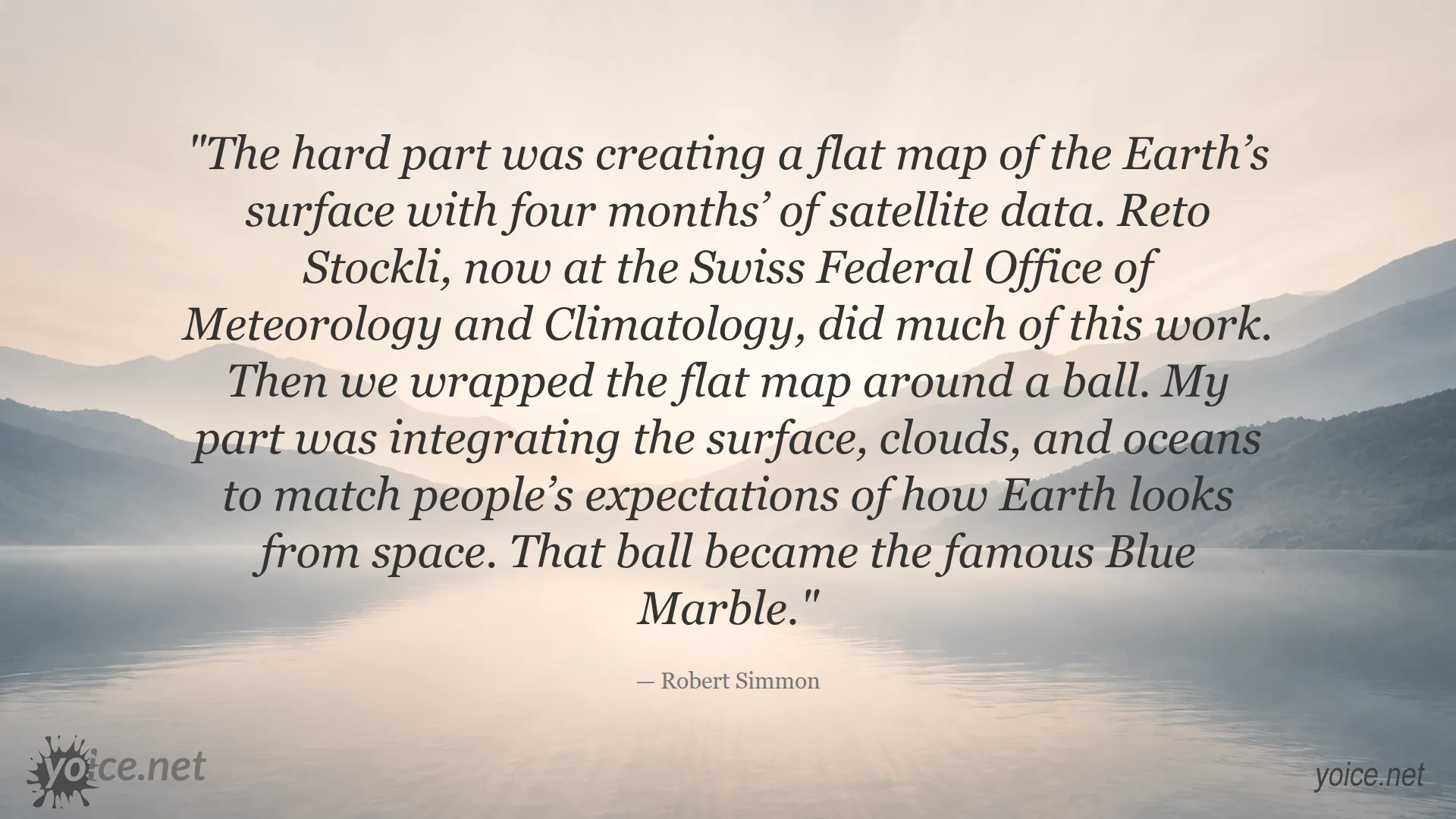
Robert Simmon is a renowned data visualizer and information designer at NASA. He is especially known for his work on creating the famous "Blue Marble," a realistic depiction of Earth that has fascinated millions worldwide. His work combines science and art to make complex data accessible and understandable for everyone.
 Copyright © yoice.net – Quote Artwork
 Copyright © yoice.net – Quote Artwork
 Copyright © yoice.net – Quote Artwork
 Copyright © yoice.net – Quote Artwork
 Copyright © yoice.net – Quote Artwork
 Copyright © yoice.net – Quote Artwork
Leave a Reply
Want to join the discussion?Feel free to contribute!